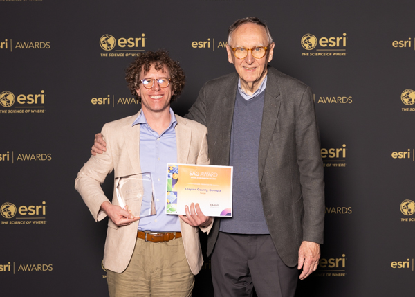
2025 Esri UC Awards Ceremony; Chandler White, Jack Dangermond (Esri cofounder and president; left-to-right)
GIS Technical Coordinator, Clayton County, Georgia
Geographic information science professional with expertise in research, spatial analysis, and modern GIS platforms
chandlerswhite@gmail.com / 334-728-2974
M.S., Geospatial Science, University of North Alabama, Florence, AL (December 2017)
Thesis: Phylogenetic patterns of invasive macrophytes in freshwater communities
Advisor: Dr. Jonathan Fleming
B.A., Geography, Auburn University, Auburn, AL (December 2009)
GIS Technical Coordinator, Clayton County Department of Information Technology (January 2024 - Present)
GIS Analyst, Clayton County Department of Information Technology (June 2023 - January 2024)
Systems Administrator, Clayton County Department of Transportation and Development (October 2018 - June 2023)
Graduate Teaching Assistant, University of North Alabama (January 2016 - December 2017)
Courses: Quantitative Methods, GIS, Physical Geography, Cartography, Remote Sensing
Research Assistant, AlabamaView (2008 - 2010)
Collected and processed environmental products derived from Landsat program platforms
Research Volunteer, Lake Watch of Lake Martin (2009 - 2010)
Collected and processed water samples using spectroradiometer and other digital sensors for eutrophication analysis
GIS & Spatial Analysis
Spatial Modeling
Data & Systems
Research Areas
Professional Certifications
Geographic Information Systems Professional (GISP)
GIS Certification Institute | Credential ID 161424 | Awarded 2022
Special Achievement in GIS Award, Esri (2025)
2025 Esri UC Awards Ceremony; Chandler White, Jack Dangermond (Esri cofounder and president; left-to-right)
Government-to-Government Award, Government Management Information Sciences, Georgia Chapter (2025)
David W. Icenogle Award for Outstanding Senior in Geography, Auburn University (2009)
Member, Geospatial Professional Network
Member, Georgia Geospatial Association
GIS Track Organizer, Georgia GMIS (May 2025)
Designed and served as instructor of record for a series of six GIS workshops at the Spring 2025 Georgia GMIS Conference.
GIS Day Workshop Organizer, Morrow High School (November 2024)
Organized and led GIS Day Expo event and GIS mini-workshop for students
Humanitarian Mapping Volunteer, Humanitarian OpenStreetMap Team (HOT) (February 2023)
Contributed 42.1 hours to earthquake response efforts in Türkiye and Syria, performing feature extraction from satellite imagery